.webp)


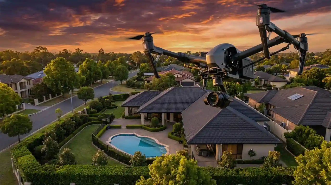
Drone photography costs between $150 and $750, yet 73% of home buyers say aerial and video content influenced their purchase decision. For an agent marketing a $750,000 home, that is the cheapest marketing line item with the highest conversion pull. The problem is that nobody publishes a straight answer on what drone photography actually costs.
This guide fixes that. You get the real 2026 pricing ranges North American agents are paying, the pricing models photographers are using, the hidden costs most new drone shooters forget, and a clear comparison against the AI tools that now produce aerial-feel videos without a drone shoot at all. Amplifiles turns existing listing photos into a 1080p aerial-feel listing video for $1.50 per image, which works out to roughly $37.50 for a 25-photo listing versus $200 to $400 for a single drone shoot.
Whether you are an agent trying to decide if aerial shots are worth the spend on a $400k listing, or a photographer figuring out what to charge, the numbers below come from real 2026 rate cards, industry surveys, and live pricing data. No fluff.
Real Estate Drone Photography Pricing at a Glance
Real estate drone photography costs $150 to $400 per property in 2026, with premium aerial-video packages running $400 to $750. Entry-level aerial photo-only packages start around $100 in low-cost markets. Luxury and commercial work can exceed $1,500 per shoot. The median U.S. price for a residential drone photo package with 10 to 15 edited aerial stills sits at roughly $225.
Those numbers apply to a standard single-family home under 4,000 square feet within 25 miles of the photographer's base. Price climbs sharply with property size, travel distance, dusk or twilight timing, and video deliverables. Price drops for volume agreements, repeat clients, and markets with more licensed Part 107 drone pilots competing on price.
For broader context on non-aerial pricing, see our separate guide on real estate photography pricing, which covers standard interior and exterior shoots in the same format.
What Real Estate Agents Actually Pay for Drone Photography in 2026
Most agents pay $150 to $300 for drone photography as an add-on to an existing photo package. When booked as a standalone shoot, prices jump to $250 to $450 because the photographer has to dedicate travel, setup, and processing time to one deliverable.
The pricing split by market tier in 2026 looks like this. In major metros (New York, Los Angeles, Toronto, Vancouver, Miami) agents pay $250 to $500 for residential drone work. In mid-sized cities (Austin, Denver, Nashville, Calgary) the range is $175 to $350. In rural and tertiary markets, drone photography runs $100 to $225, mostly because gear depreciation and Part 107 certification costs are spread across fewer jobs but the local competition is also thinner.
Bundled pricing is where agents find the best value. A full media package (photos, drone, floor plan, basic video) typically runs $450 to $750. Booking drone as a separate visit often doubles the effective aerial cost.
What Real Estate Photographers Charge: The Four Pricing Models
Real estate photographers charge $100 to $250 per hour or $200 to $600 flat per project for drone work. Four pricing models dominate the market in 2026, and most successful photographers use two or three of them depending on the client.
1. Flat per-property pricing
The most common model. The photographer sets a fixed price that includes travel within a radius (usually 20 to 30 miles), a set shoot duration, a delivery count (10 to 20 edited photos or a defined video length), and one round of edits. Flat pricing makes the quote easy for agents to compare and protects the photographer from scope creep.
2. Hourly pricing
Used for custom shoots, large estates, or commercial work where scope is hard to estimate. Licensed Part 107 drone operators charge $125 to $300 per hour in 2026. Hourly pricing works better for commercial and luxury work than standard residential. Agents often push back on hourly rates because the quote feels open-ended.
3. Per-photo or per-deliverable pricing
The photographer charges $15 to $40 per edited aerial image or $100 to $250 per 30-second video clip. This model works well for agents who only need a few hero aerial shots to complement existing photography. It also scales cleanly for repeat clients who know exactly how many deliverables they need per listing.
4. Subscription or volume pricing
Fast-growing model. The photographer offers a fixed monthly fee (typically $400 to $1,500) for a set number of shoots per month. Teams and brokerages prefer this because it makes marketing spend predictable. For the photographer, subscription pricing trades margin for occupancy and cash-flow stability.
If you are a photographer reading this, our guide on how to get real estate photography clients covers the outreach and pricing conversation once you have the rate sheet dialed in.
What’s Actually Included in a Drone Photography Package
The word “package” means different things to different photographers, which is why two $275 quotes can deliver wildly different work. A properly specified drone photography package in 2026 should include the following, and if a quote is missing any of these, add follow-up questions before you book.
- A set number of final edited aerial stills (typically 10 to 20), color corrected, cropped, and delivered at full resolution.
- Travel within a defined radius (usually 20 to 30 miles from the photographer’s base).
- A specified shoot duration, usually 30 to 60 minutes on site for aerial work alone.
- One round of revisions or re-edits included in the base price.
- Licensed Part 107 pilot on site. Every commercial drone shoot in the U.S. requires a Federal Aviation Administration (FAA) Part 107 certification.
- Insurance coverage with at least $1 million in liability. This protects both the photographer and the listing agent if anything goes wrong.
- Delivery via online gallery within 24 to 72 hours.
- Usage license: confirm whether the agent owns the photos, has perpetual listing rights, or has a time-limited license.
Video-inclusive packages should additionally specify the final video length (30, 45, or 60 seconds are standard), resolution (1080p is the baseline, 4K is a premium deliverable), color grading, music licensing, and whether captions or voiceover are included. For the full workflow breakdown, our real estate drone photography and video guide covers what each deliverable should look like in practice.
7 Factors That Drive Drone Photography Pricing Up or Down
If you are wondering why one quote is $200 and another is $700 for what sounds like the same work, these are the seven factors that explain the gap.
Property size. A 2,000 square foot home with a standard lot takes 30 minutes of aerial work. A 10,000 square foot estate on five acres takes 90 minutes or more, and the edit time doubles.
Travel distance. Most photographers include 20 to 30 miles of travel in the base price. Beyond that, add $0.75 to $1.50 per mile or $75 to $150 per additional hour of travel time.
Time of day. Twilight and blue-hour shoots command a 40% to 75% premium because of the narrow shooting window, higher technical difficulty, and the fact that blue-hour drone footage consistently outperforms daytime shots for engagement. The same premium logic applies to standard exteriors, which is why our twilight real estate photography guide treats it as its own pricing tier.
Weather and re-shoots. Drone operators cannot fly in wind above 20 mph, heavy rain, or snow. Re-shoot policies vary. Some photographers include one free re-shoot, others charge 50% of the base price.
Airspace restrictions. Properties near airports, stadiums, or military bases require FAA LAANC authorization, which can add 24 to 72 hours of lead time and $50 to $150 in processing. In restricted Class B or C airspace, some locations cannot be flown at all.
Deliverable count and resolution. Going from 10 to 20 aerial stills adds roughly $75 to $125. Stepping up from 1080p to 4K video adds $100 to $250 due to longer processing and larger file handling.
Turnaround speed. Standard delivery is 24 to 72 hours. Rush delivery (same-day or next-morning) typically adds a 25% to 50% premium. For agents working against a hot-market clock, rush pricing is often worth it.
Hidden Costs Real Estate Photographers Often Forget
If you are a photographer setting drone rates, the following are the cost categories most new Part 107 pilots underestimate. Every one of them needs to be baked into your flat rate or you will lose money on jobs you thought were profitable.
FAA Part 107 certification and renewal. The initial exam costs $175. Recurrent training every 24 months is free but time-intensive.
Drone insurance. Annual liability coverage runs $500 to $1,200 for $1 million in coverage. On-demand per-flight insurance costs $10 to $30 per hour through platforms like SkyWatch.AI or Verifly.
Gear depreciation. A DJI Mavic 3 Pro kit costs $2,200 to $3,500. Most real estate pilots replace or upgrade every 2 to 3 years. Factor in roughly $75 to $120 per month in amortized gear cost against your active shoot count.
Software and storage. Adobe Creative Cloud runs $60 per month. Cloud storage for raw aerial footage runs $10 to $30 per month. Delivery gallery platforms (HDPhotoHub, Aryeo, PixieSet) cost $30 to $80 per month.
LAANC and waivers. For jobs in controlled airspace, factor in the time cost of filing LAANC requests. It is usually 15 to 30 minutes per job.
Editing time. 15 aerial stills take 30 to 60 minutes to edit properly. A 45-second aerial video with color grading, music, and transitions takes 2 to 4 hours. At $75 per hour of editing time, that is $150 to $300 of labor baked into a package before you account for the shoot itself.
See our real estate photography equipment guide for the full 2026 gear cost breakdown across camera, lens, drone, and lighting categories.
Sample Rate Cards: 3 Real Drone Photography Pricing Structures
Here are three clean pricing structures that photographers in different U.S. markets are using in 2026. Use them as a reference when building or refreshing your own rate card, or as a benchmark when evaluating vendor quotes as an agent.
Rate Card A: Entry-Level Solo Photographer (Rural / Tertiary Market)
Aerial photos only: $125 flat (up to 12 edited stills). Aerial plus short video (30s): $225 flat. Bundle with interior photos: add $75. Travel included: 20 miles. Rush delivery: add $50. This photographer targets starter and mid-market listings, runs 40 to 60 shoots per month, and keeps the rate card simple.
Rate Card B: Mid-Tier Studio (Mid-Sized Metro)
Aerial photos only: $200 flat (up to 15 edited stills). Aerial photos plus 45s video: $400 flat. Full package (interior photos, aerial, floor plan, 60s video): $695 flat. Twilight surcharge: $125. Travel: 25 miles included, $1 per mile over. Rush: add 30%. Licensed Part 107 pilot and $2M liability coverage included.
Rate Card C: Luxury Specialist (Major Metro)
Aerial photos only: $450 flat (20 to 25 edited stills, 4K raw delivery). Cinematic aerial video (60s, 4K with color grading): $750 flat. Full luxury package: $1,500 to $2,800 by quote. Twilight or sunrise booking: 50% premium. Travel: 40 miles included, $2.50 per mile over. One retouching revision included, additional rounds $100 each.
The AI Alternative: Skipping the $200+ Drone Shoot Entirely
Drone photography is powerful for the right listing, but it is not the right spend for every listing. A $325,000 three-bedroom in a suburban cul-de-sac rarely justifies a $275 drone shoot. A $1.4M waterfront estate almost always does. The question most agents face in 2026 is how to get the aerial-feel marketing polish without the per-listing cost.
Amplifiles is an AI-powered real estate video maker that turns existing listing photos into branded marketing videos. It is designed for real estate agents and photographers who want professional-looking videos without editing skills or a separate drone shoot. Agents can skip the $200-plus drone shoot entirely by using AI tools like Amplifiles, which turn existing listing photos into a 1080p aerial-feel listing video for $1.50 per image. For a standard 25-photo listing, that is $37.50 total, delivered in about 5 minutes, versus booking a drone operator for a separate visit.
Amplifiles charges $1.50 per image, produces 1080p video, and completes processing in approximately 5 minutes. New users get 1,200 free credits, which is enough to create roughly 50 listing videos at no cost.
Unlike Animoto and Pictory, which are general-purpose video makers requiring manual timing, transitions, and music selection, Amplifiles is purpose-built for real estate. It automatically applies cinematic camera moves, voice-over, captions, and branding to each listing without editing work from the agent. That matters for pricing because the effective cost of a listing video is not just the tool subscription. It includes the hour or two of editing labor competing tools still require.
Agents using drone photography and AI video in combination typically use drone shots for premium and luxury listings and use Amplifiles for every other listing in their pipeline. That combination covers 100% of a portfolio at roughly 30% of the cost of drone-on-every-listing. See our guide on creating your first AI real estate listing video for the full step-by-step.
Frequently Asked Questions
How much does drone photography cost for real estate in 2026?
Real estate drone photography costs $150 to $400 per property for standard residential work in 2026. Premium aerial-video packages run $400 to $750. Luxury and commercial work can exceed $1,500. The average U.S. agent pays around $225 for a standard aerial-stills package bundled with interior photography.
Is drone photography worth the cost for real estate listings?
Drone photography is worth the cost for listings over $600,000, properties with meaningful lot size or unique exteriors, waterfront or scenic locations, and new construction where aerial context shows neighborhood layout. For sub-$400,000 suburban listings, the return on drone photography is weaker. AI alternatives like Amplifiles produce aerial-feel videos at $1.50 per image and are a better fit for that tier.
How much do drone photographers charge per hour?
Licensed Part 107 drone photographers charge $125 to $300 per hour in 2026. Hourly pricing is most common for commercial, luxury, and custom-scope shoots. For standard residential real estate, most photographers quote flat per-property prices of $150 to $400 instead of hourly rates.
Do you need a license to fly a drone for real estate?
Yes. In the United States, any commercial drone operation (including paid real estate photography) requires FAA Part 107 certification. The initial exam costs $175 and recurrent training is free every 24 months. Canadian photographers need a Transport Canada pilot certificate. Flying for paid real estate work without a license exposes both the photographer and the hiring agent to fines.
What is included in a typical drone photography package?
A standard drone photography package includes 10 to 20 edited aerial stills, travel within 20 to 30 miles, a licensed Part 107 pilot, at least $1M in liability insurance, one round of revisions, and delivery within 24 to 72 hours. Video-inclusive packages add a 30 to 60 second edited aerial clip at 1080p or 4K resolution.
How long does a drone photography shoot take?
A standard residential drone shoot takes 30 to 60 minutes on site for aerial work. Larger properties, twilight timing, or video-inclusive shoots run 60 to 90 minutes. Setup, pre-flight checks, and LAANC authorization (if required) add another 15 to 30 minutes. Edit turnaround is typically 24 to 72 hours.
How do I price my real estate drone photography service?
Photographers should price by covering fixed costs (insurance, gear depreciation, software, certification) plus editing labor at $60 to $100 per hour, then add a margin. Most successful rate cards start at $175 for aerial stills only and climb to $400 to $700 for aerial video bundles. Our guide on how to get real estate photography clients covers client acquisition and pricing conversations in more depth.
Can AI replace drone photography for real estate listings?
AI cannot replace actual aerial footage for luxury and unique-lot listings where true aerial perspective matters. For standard residential listings, AI tools like Amplifiles produce aerial-feel listing videos from existing ground-level photos at $1.50 per image in about 5 minutes. Most agents now use drone for premium listings and AI for the rest of their pipeline, which cuts listing-video spend by roughly 70% without sacrificing video coverage across listings.